Mt Clement Antinomy-Gold Project
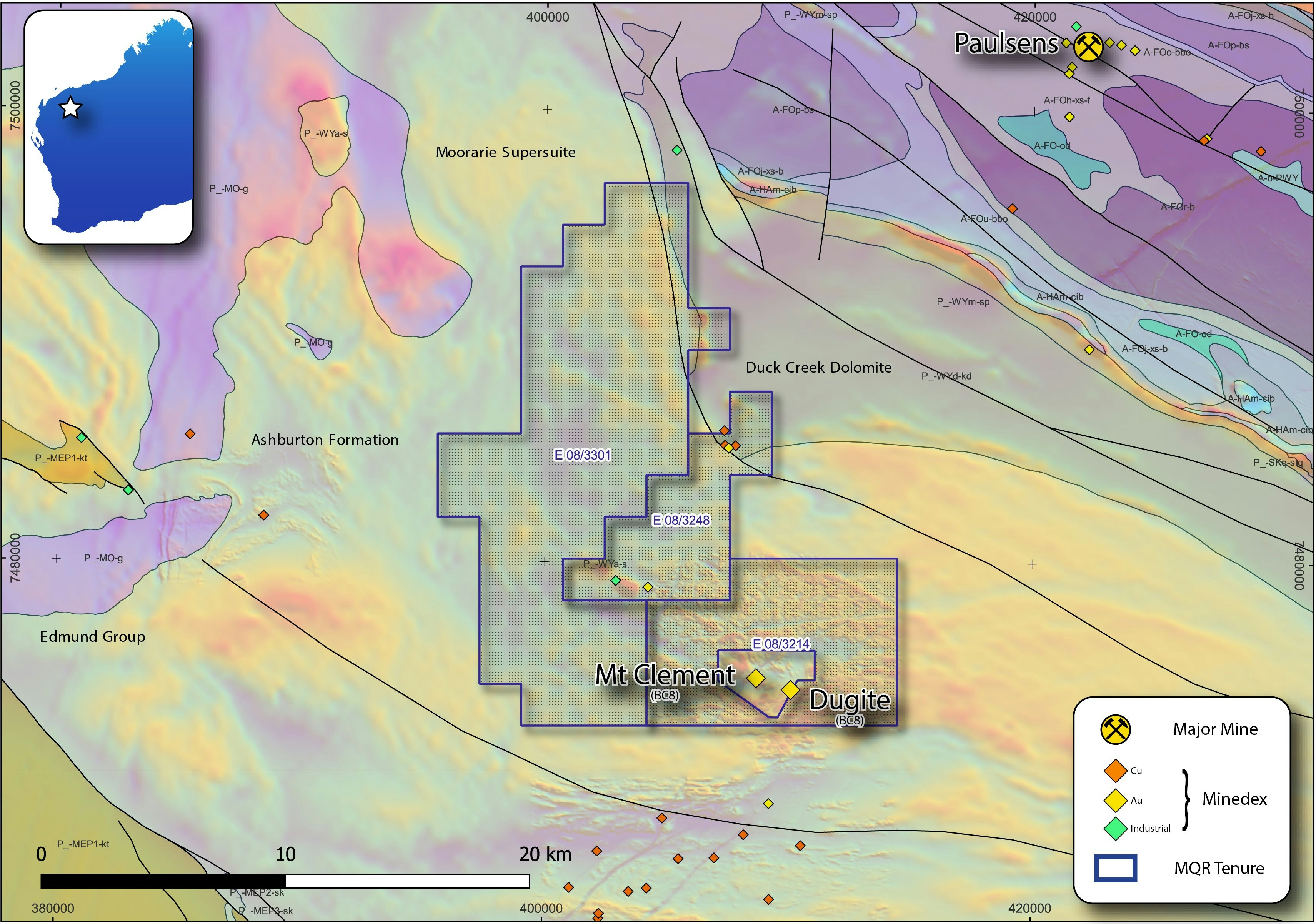
The Mt Clement Project (Mt Clement) is located 30km SW of Black Cat Syndicate's (ASX:BC8) Paulsens gold mine, at the western end of the Ashburton Basin in the northern Capricorn Orogen of Western Australia.
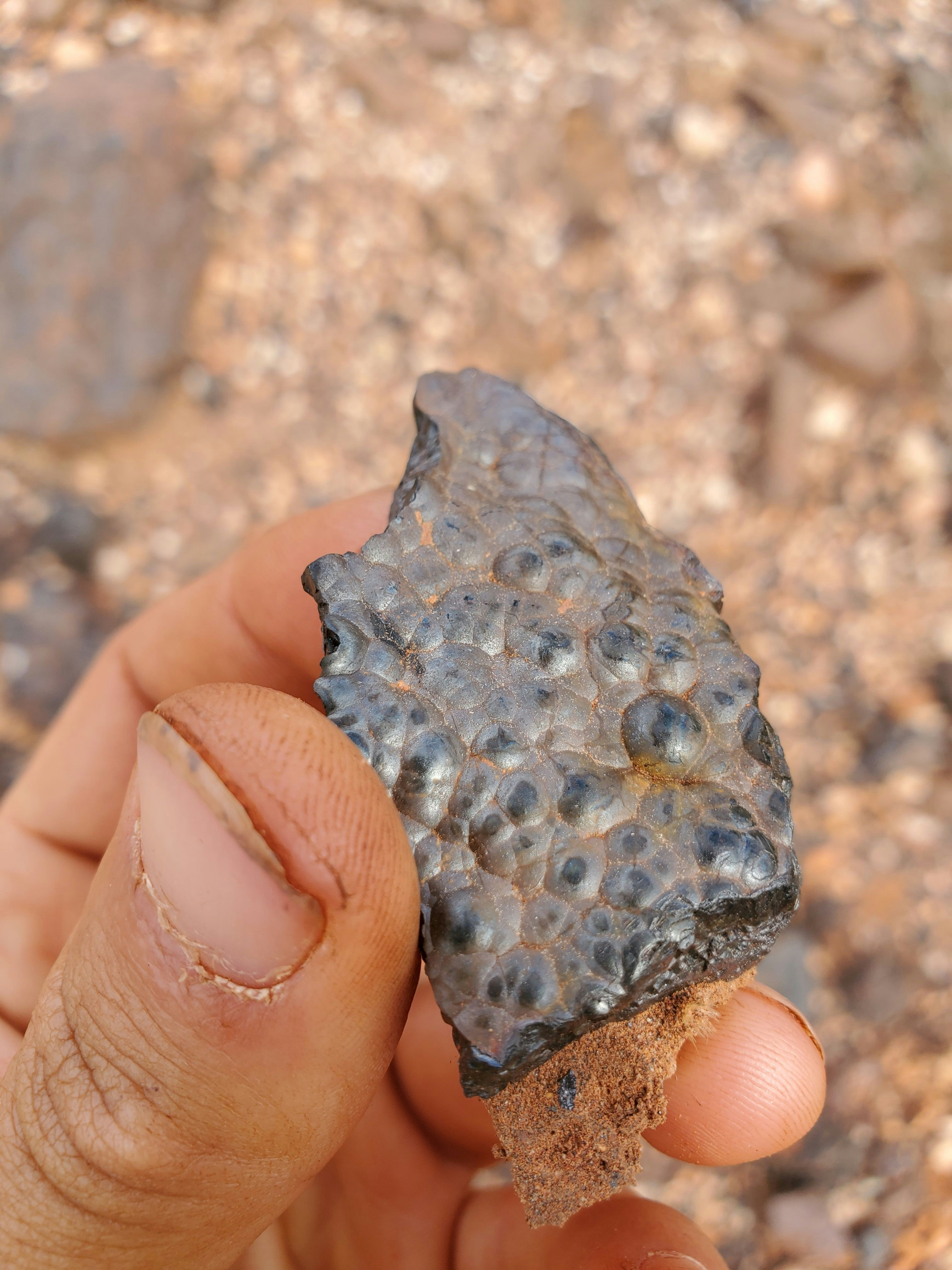
Mt Clement consists of 398km2 of tenure prospective for syngenetic gold-antimony mineralisation, a poorly understood and underexplored mineralisation style in the Ashburton Basin.
Importantly, Mt Clement represents a genuine greenfields opportunity in one of Australia’s most underexplored regions.
There has been debate over the mineralisation style observed at Mt Clement, however a recent study suggests Mt Clement is most likely a syngenetic exhalative-style deposit, similar to the Eskay Creek Au-Ag deposit in British Columbia and was deposited broadly coeval with the deposition of the Ashburton Basin (Guilliamse, JN 2020).
The current understanding of the geology of Mt Clement is simplistic with rock units broadly mapped as the Ashburton Formation. Marquee acquired detailed aeromagnetic data over the immediate Mt Clement area, which highlighted complex magnetic signatures and potentially provides insight into the mineralising processes occurring in the subsurface.
Mt Clement is associated with discrete magnetic highs within a broader zone of low magnetic signature. The interpretation is that the low-magnetic zones may represent granitic intrusions at depth, a potential fluid source for mineralisation, while the discrete magnetic highs represent hypogene and supergene alteration (forming iron-oxides) of the metasedimentary host rocks.
Using Mt Clement as an analogy, by targeting areas with discrete magnetic highs proximal to broad magnetic lows, Marquee has identified a number of targets where similar geological and mineralising processes may have occurred.